thursday, october 16, 2008
A map of three summers in the Bay Area
Here’s a book I made recently for my book arts class. I’ll talk about my other classes at some point too.
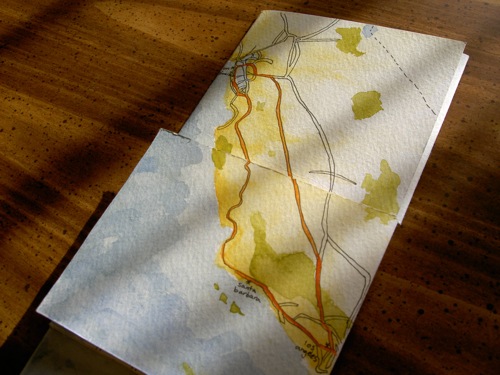
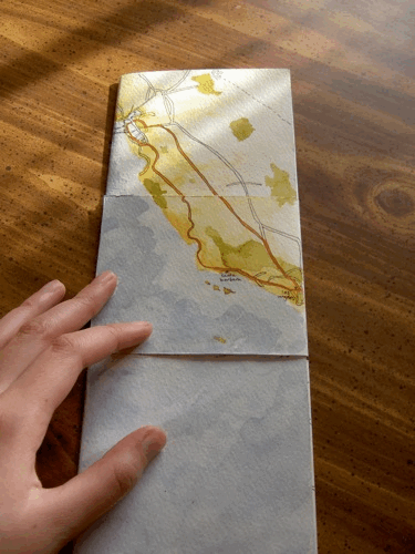
This is a tetra-tetra flexagon that folds open three times to zoom in from California to the Bay Area to San Francisco to the Mission/Castro area. A flexagon sounds fancy but it’s just one piece of paper cut and folded in a certain way — here are directions for making your own (it’s easy, but it helped me to see them in person first).
This map only covers what I know. I labeled the cities and neighborhoods that I’m familiar with, and I left areas blank if I haven’t spent much time there. (Except I left parts of the Mission/Castro blank because I’d gotten tired of tracing and painting.)
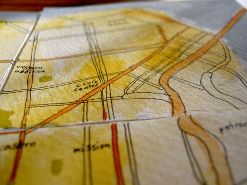
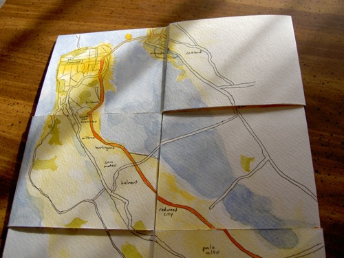
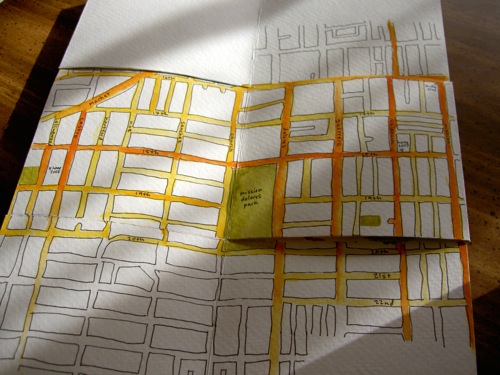
A darker yellow background means I’ve spent more time in that area. A darker orange freeway or street means I’ve traveled along it more often. Green means a park.
So, this book is a way to look at my three summers during college, focused on the past two summers because I couldn’t put the Sunset, the Mission, and the Castro together on one spread. If you fold up the map from its fully open state above, it tells a kind of story:
[4: Mission/Castro] I lived at 18th & Valencia in summer 2007 and 19th & Collingwood in summer 2008 (and 41st & Irving in summer 2006), and I spent a lot of time near those places. [3: San Francisco] I wandered around the city on weekends. [2: Bay Area] On weekday mornings I walked to the Yahoo! shuttle stop at 16th & Mission and rode to Santa Clara, and on weekday evenings I returned the same way. [1: California] At the beginning of each summer, I went from Santa Barbara to Los Angeles for a couple weeks since that’s my home, and then I went up to San Francisco. At the end of the summer, I returned from San Francisco to Los Angeles and then went back to school in Santa Barbara. I work part-time remotely from here.
An animation of reading the book, starting with it closed:
This book also ties in with the Flickr photo map of my summer photos and seeing the Bay Area from above when flying to New Jersey for a few days during the summer, when my grandpa was dying, which is the part of my summer that the map doesn’t reflect.