thursday, june 28, 2012
The neighborhood crude oil tanks
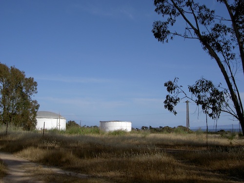
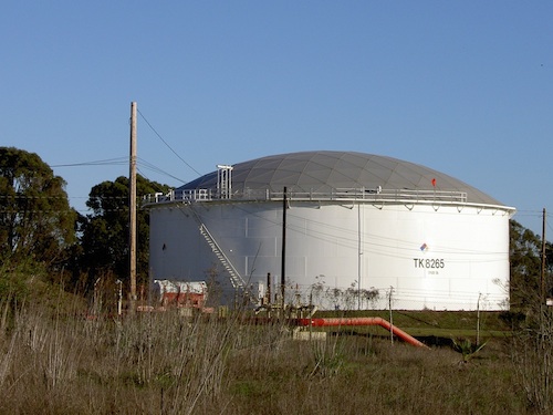
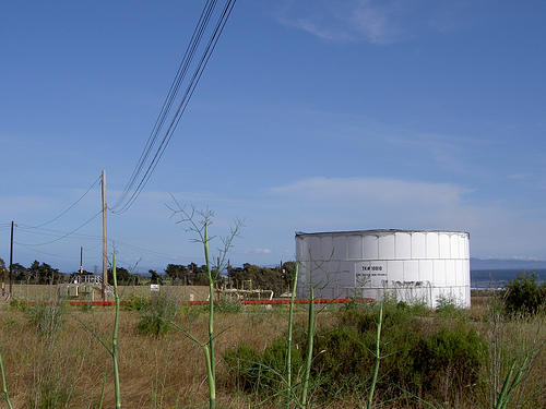
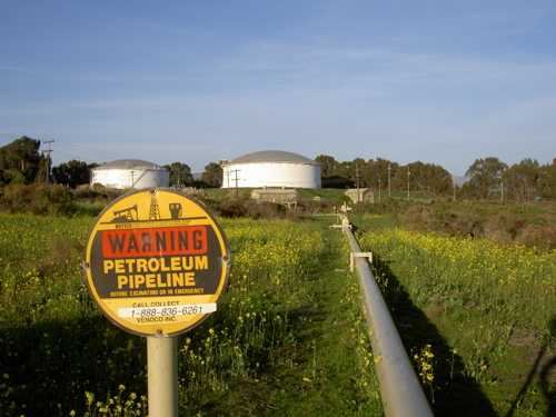
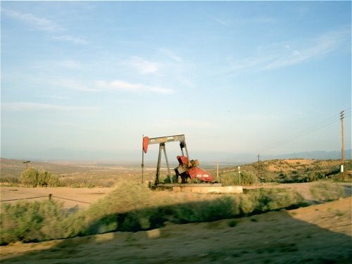
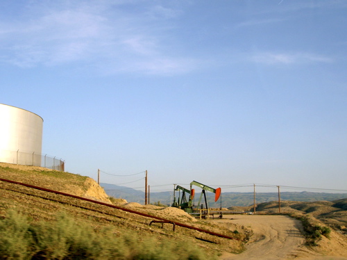
I grew up in Los Angeles where there are a lot of oil wells, usually somewhere out along a freeway. (I always liked the wells you can see on the way to LAX, ones that look like dinosaurs eating from the ground.) In Santa Barbara, our oil wells are out in the ocean, and the university-owned nature preserve leases some space to an oil company to store crude oil drained from the ocean floor. This nature preserve is next to the neighborhoods around the university, and you can just walk out into the fields and look at the tanks with their coded markings and geodesic dome tops.
Nobody really tells you that the tanks are there, since most people either don’t find them particularly spectacular or haven’t been to the nature preserve. You hear about them when you acquire a boyfriend who lives next to them; he shows them to you because you both like infrastructure. (From his apartment we listened together to trains whistling, the coastal fog horn, and airplanes headed to and from the little airport next to the university.) We found out about a historic gas station down the road, built as a showcase by one of the oil companies in the 1920s, now picturesquely defunct and a favorite of everybody in town with a fancy camera. On a few Saturdays we took long driving trips to visit other oil fields — he’d tell me we were going on an adventure, and a couple hours later I’d look out to see more oil pumps than I’d ever seen in one place before.
The native Chumash people used the natural tar on the beaches here to caulk their canoes, and the tar still comes up and caulks the bottoms of your feet if you’re not careful while walking on the sand. There was even an asphalt mine for a couple years in the late 1800s where the Art Department building is now; there are a few surprising pictures of very grimy-looking men hauling things around the campus lagoon.
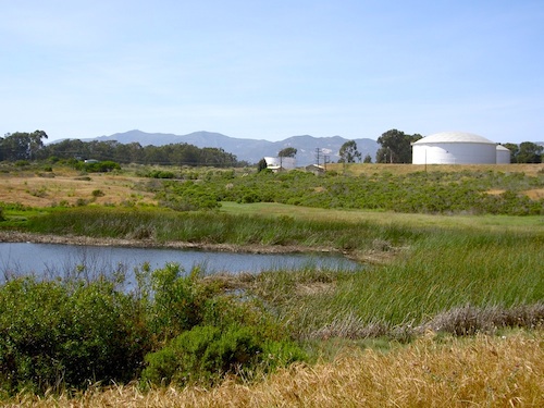
I’ve read that the oil company’s lease on this nature preserve land ends in 2016 and the university doesn’t plan to let them renew it, which makes sense, but I like living in a place where its history is so close to the surface. By looking you can find clues that this land was once a slough, then ranches, then explored for oil, then a small WWII marine base, then a university nature preserve. It’s not heavily developed enough yet to obscure the origins of the place, unlike where I grew up in LA — where old underground oil developments sometimes come back to bite people in the form of gas explosions, and where the remaining active oil wells are carefully hidden.
comments (0)
wednesday, august 18, 2010
Augmented reality for non-programmers
When people care about the place where they live, they often end up helping make it a better place. But how do people get interested? It might help if the history of that place is brought to the surface, making its compelling stories more noticeable. A good local newspaper or blog can do this, but only if you find one and read it regularly. An augmented-reality mobile app might be able to do this instantly for anyone curious about their surroundings, but only if they have that device. What about for everyone? These are some stories about a place I like.
Isla Vista is the only neighborhood right next to UCSB, and it has a bad reputation as a half square mile of drunken student parties. It is that, but it’s also a lively dense community with its own complex history, where people walk and bike everywhere, with more of a sense of place than you can find in some whole cities. It’s noisy on weekend evenings (starting on Thursday), and if you’re used to nice suburban neighborhoods then it probably looks like a crowded mess, but it’s interesting and deserves more than the usual stories of terrible landlords and beer pong tournaments.
A few examples of Isla Vista’s self-image: there’s a local blog called Only in IV where all the posts are photos of drunk student shenanigans (and a few beach sunsets), the more outrageous the better. A website called The Dark Side of UCSB compiles and sensationalizes statistics about crime and drugs in Isla Vista, with the attitude that these problems are endemic to IV and can’t be avoided or improved. A personalized map of the Santa Barbara area, with Isla Vista on the left, describes it as “STDs, broken glass, sex, loud music, bikes, theft, bike theft.” A photo essay describes IV as a “teeming ghetto paradise…Children or adults are odd apparitions here…Trampolines and beer pong tables litter most yards…a glorious mess of potential and pollution, treasure in trash.” All of this is only one aspect of IV, mostly Del Playa Drive (the street closest to the ocean), but it’s the reputation of the whole place.
So I spent my first three years at UCSB mostly ignoring Isla Vista. I only walked in to get a sandwich or cookies (a friend had told me about the IV food co-op), and sometimes I ran into the main park along the way. It’s a very nice park, with lots of trees and a little pond, and this confused me then because IV was supposed to be some kind of den of stupidity, not a lovely place to escape from campus for a little while. In my fourth year I moved to an apartment there with a friend, and out of curiosity I started walking around, taking photos, and googling what I found. (And then I started playing Noticin.gs, which turned these walks from “occasionally” to “every single day, up and down as many streets as possible.”) I learned that when you look carefully at a place, it starts to tell a story.
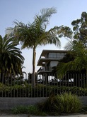
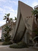
Each thing in Isla Vista has something to say: a small stand of oak trees remaining from a very old forest that helped feed the nearby Chumash village (until the Santa Barbara Mission moved in), an earthquake-damaged polo barn built by a gentleman rancher a hundred years ago, place names with grammatically incorrect Spanish phrases thanks to speculative land developers in the 1920s (Isla Vista, Del Playa, etc.), kitschy apartment buildings built in the 1960s after UCSB moved to the defunct marine base campus next door, a system of pretty little parks developed as part of post-riot community organizing in the 1970s, a solar-powered parking lot built last year as part of a “Master Plan” to fancy up the area, and a zillion other bits and pieces within this half square mile that is more interesting than it looks at first.
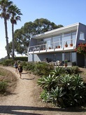
But few people have the time or inclination to develop a gigantic enthusiasm for local land-use history, so a lot of students graduate from UCSB without ever seeing the fancy old barn, or learning why the street names are so weird, or noticing the lovely modern houses at the end of Del Playa — and now I think they’ve missed out on something good. IV is not a place where most people want to live for decades if they have a choice (hearing drunk guys peeing on the plants outside your window gets annoying, and thumping party music from next door probably doesn’t help babies sleep, and did I mention that most of the housing stock was cheaply built in the 60s and hasn’t been properly maintained), but it offers an alternative to the anonymous apartments and quiet single-family houses that we’re all likely to drive home to for the rest of our lives.
Fortunately there are a lot of students (and other residents and friends) who love IV and work to keep the good side of it healthy through participating in the food and housing co-ops, organizing all-ages live music shows, helping out the homeless residents, painting fantastic murals (official and unofficial), picking up trash, publishing a local magazine with the help of the university, making community banners, and lots more. But there’s something that could be added to this, counteracting the kind of short-term memory that comes from most of the population spending fewer than four years in the place. You can collect parts of the story if you search around a lot: an UCSB and Isla Vista Walking Tour and Historical Accounts and Maps of the Goleta Slough (both compiled by a UCSB physics professor), “Goleta, the Bad Land” (an article about the town next door), a graduate student project covering the history of the IV Parks and Recreation District (although those PDFs seem to no longer be online), and a couple of works from specific activist points of view: Isla Vista: A Citizen’s History and Don’t Bank on Amerika.
So I read everything about IV that I could find online, and my nice patient friends listened to me when I went into the mode of “Area Man Way Too Into Local County History” and rambled about why this or that church building in IV is fascinating, or about my gleeful discovery of the Tree Monument, or finding bushes of blackberries along a sidewalk. So I decided to put all of this together and hold a walking tour for whoever wanted to come. We talked about The Big Here, we had fun, it was very dorky, and I learned that this wasn’t scalable to large numbers of people (both because it’s tough to yell loud enough for a crowd, and because not many people voluntarily show up for this kind of thing). Here are my raw notes for it. What next?
I like interpretive signs, so I thought about whether IV could use some of those, but I think that kind of informative historical marker sometimes fossilizes the subject instead of bringing it alive — it becomes something to look at from a distance, a mediated artifact. I like sidewalk plaques better in many cases, since they don’t interfere with your view of a structure or place, instead quietly adding to the ground if you want to look down and learn more.
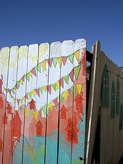
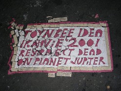
So I’d like to install some sidewalk plaques in IV! Traditional bronze markers would be very expensive (and require who knows what kind of permission and work to install), but there’s an alternative made with linoleum: messages in the style of Toynbee tiles, which are crackpot graffiti anonymously glued to asphalt roads in a few cities:
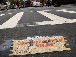
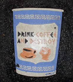
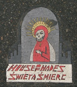
I found a guide to making this type of tile, and they sound labor-intensive but doable. They break apart after a few years, but that’s fine. You can make different shapes and designs, like these:
I’d like to install tiles that add little bits of information to places around IV, just enough so that a curious viewer would have a clue toward what to search for on Google:
- GEODESIC HOUSE BUILT IN ‘73 BY GRAD STUDENT
- SUBDIVISION ONCE CALLED ORILLA DEL MAR ↵
- EST. IN 1950s AS A GENERAL STORE
- FORMER PUNK VENUE & HOMELESS SHELTER ⇒
- “DINGBAT” ARCHITECTURAL STYLE
- ← CAJE: FINEST COFFEE FOR MILES
Or something like that. It’d be perfect if these tiles looked mysterious and a little crazy, but you could also use them as anchors for an extensive pamphlet/online walking tour of IV. All of this would probably be eligible for a UCIRA Undergraduate Action Research Grant to cover the cost of materials and maybe support a couple people working on it for a summer. I’m no longer hanging around Isla Vista most of the time, but I’m hoping that somebody else might be interested in doing this someday. If you are, let me know!
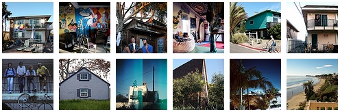
The same idea with fewer words: photos of Isla Vista in 2009, my last year at UCSB, and post-college visting UCSB and IV.
comments (5)
thursday, april 12, 2007
Oil wells, containerization, trains, love
When I saw Edward Burtynsky’s pictures of oil fields and containers a couple years ago, I knew that he had taken the pictures I’d been thinking about since I was a little girl staring out the car window at oil wells that looked like dinosaurs. Doug likes odd industrial things too, so we went to UCSB’s screening of Manufactured Landscapes, which turns Burtynsky’s pictures and picture-making process into a quiet and wonderful narrative.
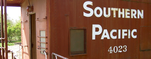
A few days later, we visited the Goleta Depot railroad museum, which has one real exhibit: a neat old caboose. Next door, you can buy reproductions of lemon packing labels, homemade persimmon jam, and little xeroxed pamphlets that explore Santa Barbara County history.
Then we wandered around California and looked at oil wells.
comments (0)
thursday, march 22, 2007
It’s OK enough to show the world
My final assignment for New Media class was to use Flash to create a “new media work” that “uses a diagram or map as its interface”. I know that the only good Flash movies are entertaining (see monkey pops, la historia del mamut, etc.), but of course I tried to make something informative and useful — while wondering why I was having such a hard time. This is the result:
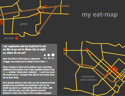
It’s an eat-map (ha ha, like heat-map) of the Santa Barbara area: a bunch of mini-reviews of restaurants I’ve visited with Doug. Then I wrote five pages about the implications of this project:
…my eat-map displays narratives, facts, words, and images in order to both memorize and communicate…these mundane facts are collected and pored over as ways to more efficiently exchange money for satisfying experiences…by putting these experiences into information, I reveal the shapes and forms within them: a spatial memory of where restaurants are, shaped into a map; a knowledge of how often we go out to eat, reduced into the sizes of circles…blah blah blah.
If you don’t want to bother with new media, here is my list of good places in the Santa Barbara area, ordered by closing time:
- Andersen’s — 9 pm
- Fresco — 9 pm (Sun closed)
- Dish Cafe — 9 pm (Sun closed)
- Playa Azul Cafe — 9 pm (Fri-Sat 10 pm)
- Flavor of India — 10 pm (Fri-Sat 10:30 pm, Sun closed)
- Sojourner Cafe — 11 pm (Sun 10 pm)
- Paradise Cafe — 11 pm
- Blue Agave — 11:30 pm
- Woodstock’s — 12 am (Fri-Sat 1 am)
comments (2)
monday, february 26, 2007
Dandelions, daisies, buttercups
A survey of common weedflowers in Isla Vista, California:
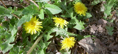
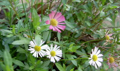
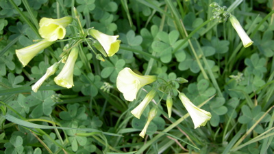
None of them are native plants. (More about buttercups.)
What are the weedflowers in your area? Show me! You have an exception from this assignment if you live here too.

